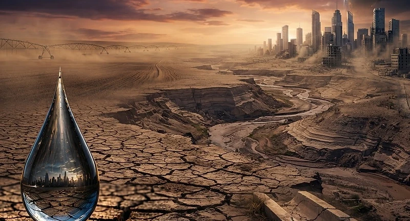
Why Water Will Be the Defining Crisis of Our Century
Beneath our feet, a hidden clock is ticking. While we glance at the blue marble from space and mistake abundance for reality, the water that sustains our agriculture, our cities, and our very survival is disappearing at an irreversible rate. From the emptying aquifers of the Great Plains to the parched megacities of the developing world, the crisis is not an approaching threat, it is a present-day catastrophe. This book exposes the systemic failure to value our most precious resource, revealing how political, economic, and industrial structures have conspired to turn a finite life-source into a dwindling debt. You will uncover the truth behind the 'hidden water' in your daily purchases, the dangerous illusions of our water economy, and the reasons why we are, quite literally, draining the future. If you still believe that water will always be there when you turn the tap, you are looking at the wrong numbers. The tap is open, the reservoir is dropping, and the time for complacency has passed. Will you wait until the last drop?
✦Urgent Investigation: Discover the shocking reality behind the global water crisis before the wells run dry.
✦Eye Opening Facts: Learn how your daily purchases secretly consume massive amounts of hidden water.
✦Systems Under Fire: Challenge the economic and political structures that threaten our most precious resource.
If you enjoyed The Water Will Come by Jeff Goodell or Cadillac Desert by Marc Reisner, you will love this book for its compelling blend of investigative journalism and environmental urgency.
Get the Book
Bought this book? Claim your free eBook
If you have already bought The Last Drop by David Oldham, tell us where to send it and we will email you the eBook version, free. You keep reading on any device.
Chapter 2: The Aquifer Clock Beneath the surface of the Earth, hidden from satellite cameras and the evening news, a clock is ticking. It is not a metaphorical clock, not a rhetorical device designed to inject urgency into an otherwise abstract policy discussion. It is a real, measurable, quantifiable countdown, and when it reaches zero, the consequences will be felt by billions of people in the form of the most basic and irreversible catastrophe imaginable: the permanent loss of the water that grows their food. The clock is the declining water table of the world's great aquifer systems - vast underground reservoirs of freshwater, some of them stretching across thousands of kilometres beneath the surface of entire continents. These aquifers have sustained human civilisation for millennia. They feed the wells that irrigate the fields that produce the grain that feeds the population. And they are being drained at a rate that should make every government on the planet lose sleep, but that barely registers in political discourse because the depletion happens underground, invisible, silent, and easy to ignore until the day the pump draws nothing but air. What Lies Beneath 23 To understand the aquifer crisis, you must first understand what an aquifer actually is, because the word conjures images that bear little resemblance to reality. An aquifer is not an underground lake. It is not a vast cavern filled with water, waiting to be tapped like a barrel. An aquifer is a geological formation - typically porous rock, sand, or gravel - that holds water in the spaces between its particles, like a sponge saturated with liquid. The water moves through these formations slowly, measured in metres per year or even metres per century, flowing along pressure gradients and geological contours that were established millions of years before the first human being sank the first well. There are two fundamentally different kinds of aquifer, and confusing them is one of the most consequential errors in water policy. The first is a renewable aquifer. These are formations that are connected to the surface water cycle - they receive recharge from rainfall that percolates down through soil and rock, replenishing the water that is extracted from below. In principle, a renewable aquifer can be used sustainably, provided the rate of extraction does not exceed the rate of recharge. In practice, this balance is maintained almost nowhere on Earth. Across every continent, renewable aquifers are being pumped faster than they can refill, and the water tables are falling year on year. The second kind is a fossil aquifer, and this is where the story turns from concerning to terrifying. A fossil aquifer is a formation that was filled with water thousands or millions of years ago - often during wetter climatic periods that no longer The Last Drop 24 exist - and is effectively sealed off from the modern water cycle. Rainfall does not recharge it. Snowmelt does not reach it. The water it contains is a one-time geological inheritance, as finite and non-renewable as the oil that lies in similarly ancient formations nearby. When you pump water from a fossil aquifer, you are spending capital. You are liquidating an asset that took geological time to accumulate and that will never be replenished on any timescale meaningful to human civilisation. The water you extract today will not be replaced in your lifetime, your children's lifetime, or your grandchildren's lifetime. It will not be replaced in a thousand years. For all practical purposes, it is gone. And yet, across the world's major agricultural regions, this is precisely what is happening. Fossil water is being pumped to the surface, used to irrigate crops, and lost to evaporation and runoff. The food it produces feeds billions. The aquifers it comes from are emptying. And no one has a plan for what happens when they are gone. The Ogallala: Draining a Continent's Inheritance Beneath the Great Plains of North America lies one of the largest aquifer systems on Earth. The Ogallala aquifer - more formally known as the High Plains aquifer - stretches across approximately 450,000 square kilometres, underlying portions of eight states and sustaining one of the most productive agricultural regions in the world. The grain, cattle, and cotton produced above the Ogallala feed not only the continent but, through exports, significant The Last Drop 25 portions of the global food supply. The Ogallala was formed between two and six million years ago, during the Pliocene epoch, when sediment washing down from the newly risen mountains to the west created vast beds of sand, gravel, and clay that filled with water over geological time. In some areas, the saturated formation reaches thicknesses of over 300 metres. The total volume of water stored in the Ogallala has been estimated at approximately 3,600 cubic kilometres - a staggering quantity, roughly equal to the volume of one of the great lakes on the continent's surface. For thousands of years, this water sat undisturbed beneath the plains. The indigenous peoples of the region lived on surface water - rivers, streams, seasonal pools. The aquifer was unknown and untouched. It was only in the twentieth century, with the development of powerful centrifugal pumps and centre-pivot irrigation systems, that the Ogallala was opened up for large-scale extraction. And when it was, the transformation was extraordinary. The semi-arid grasslands of the Great Plains became one of the most productive agricultural zones on the planet. Fields that could barely sustain dryland farming were suddenly producing enormous yields of wheat, maize, sorghum, and cotton, all watered by the ancient reserves beneath them. The problem, of course, is that the Ogallala is predominantly a fossil aquifer. Recharge rates across most of its extent are negligible - a few millimetres per year at best, in contrast to extraction rates that are measured in metres per year. The arithmetic is simple and damning: water is being removed from The Last Drop 26 the Ogallala roughly ten times faster than it is being replaced. In the southern portions of the aquifer, where the formation is thinner and recharge is lowest, the water table has dropped by more than 30 metres since large-scale pumping began. Some areas have already been effectively exhausted, with wells going dry and irrigated farmland reverting to dryland conditions or being abandoned entirely. The total volume of the Ogallala has declined by an estimated 410 cubic kilometres since 1950. At current extraction rates, significant portions of the aquifer will be functionally depleted within 25 to 50 years. The food production that depends on it - production that feeds hundreds of millions of people and underpins agricultural export markets worth tens of billions of dollars - will decline correspondingly. This is not a distant threat. It is a process that is already underway, measurable in the falling water levels of monitoring wells, visible in the shrinking irrigated acreage of the southern plains, quantifiable in the declining yields of farms that once boasted the highest productivity on the continent. The North China Plain: Feeding a Billion on Borrowed Time If the Ogallala story is alarming, the aquifer crisis beneath the North China Plain is existential. The North China Plain aquifer underlies one of the most densely populated and agriculturally intensive regions on Earth, supporting the grain production that feeds a substantial fraction of the world's largest population. The crops grown above this aquifer - predominantly wheat and maize The Last Drop 27 - are not luxury exports. They are staple foods on which hundreds of millions of people depend for daily survival. The North China Plain aquifer has both renewable and fossil components, but the extraction rates have long since overwhelmed the renewable recharge. The water table has been falling at rates of one to three metres per year across large portions of the plain, forcing farmers to drill ever deeper wells to reach water that is retreating faster than their drills can follow. In some areas, wells that were 20 metres deep a generation ago must now be drilled to 200 metres or more. The consequences extend beyond agriculture. As the aquifer is depleted, the land above it is subsiding - literally sinking - as the geological formations compact in the absence of the water that once supported them. Parts of the region have subsided by more than two metres, damaging buildings, infrastructure, and the very geological stability of the ground on which cities are built. This subsidence is irreversible. Even if the aquifer could be refilled - and it cannot, not at anything approaching the rate at which it is being emptied - the compacted formations would never recover their original volume. The land that sank will remain sunk. The authorities have undertaken massive engineering projects to address the crisis, including enormous canal and pipeline systems designed to transfer water from the wetter southern regions to the arid north. These projects are engineering marvels. They are also acknowledgements of a fundamental truth: the aquifer that sustained the north is failing, and no amount of efficiency or The Last Drop 28 conservation can change the fact that the water beneath the plain is running out. The Arabian Peninsula: The Mirage Economy Nowhere on Earth is the disconnect between water consumption and water reality more stark than across the Arabian Peninsula. This is a region of extreme aridity, where natural freshwater resources are among the scarcest on the planet. Average annual rainfall in many areas is below 100 millimetres. Surface water is virtually non-existent. And yet, for decades, the nations of this region have sustained populations, cities, agriculture, and industry at levels that bear no relationship to the available renewable water supply. The explanation lies beneath the desert. The Arabian Peninsula sits atop vast fossil aquifer systems - the Saq-Ram, the Wajid, the Umm er Radhuma, among others - that were filled during wetter climatic periods tens of thousands of years ago. These aquifers contain enormous volumes of water, but they receive effectively zero recharge under present climatic conditions. Every litre extracted is a litre that will never be replaced. For decades, this fossil water was pumped to the surface and used, among other things, to sustain large-scale wheat cultivation in the desert. The image was extraordinary - golden wheat fields stretching across landscapes where rainfall could not sustain a weed - and it was presented as a triumph of human ingenuity over natural constraints. In reality, it was a triumph of accounting fraud, sustained by liquidating a geological asset and booking it as The Last Drop 29 income. The wheat programme has since been scaled back dramatically as the unsustainability became impossible to ignore, but the underlying pattern of fossil water depletion continues. Desalination plants now provide a significant portion of the region's drinking water, but desalination is energy-intensive, expensive, and does nothing to replace the aquifer reserves that are still being drawn down for agriculture and industry. The aquifer clock across the Arabian Peninsula is ticking particularly loudly. Some estimates suggest that at current extraction rates, the major fossil aquifers in the region could be substantially depleted within 30 to 50 years. The political and social consequences of that depletion - in a region already marked by geopolitical tension and rapidly growing populations - are difficult to overstate. The Indo-Gangetic Basin: The Weight of a Billion Perhaps the most consequential aquifer crisis on Earth is unfolding beneath southern Asia, in the Indo-Gangetic basin. This vast alluvial plain, formed by sediment deposited by some of the world's great river systems, supports one of the highest population densities on the planet. The agriculture of this region - rice, wheat, sugarcane, pulses - feeds over a billion people. The groundwater beneath the Indo-Gangetic plain is the lifeline. As surface water from rivers has proven insufficient for the demands of intensive agriculture, millions of tube wells have been sunk into the aquifer, creating a vast, largely unregulated network The Last Drop 30 of extraction points. The result is a classic tragedy of the commons: each individual farmer, acting rationally
Beneath our feet, a hidden clock is ticking. While we glance at the blue marble from space and mistake abundance for reality, the water that sustains our agriculture, our cities, and our very survival is disappearing at an irreversible rate. From the emptying aquifers of the Great Plains to the parc
Who wrote The Last Drop?
The Last Drop was written by David Oldham.
What genre is The Last Drop?
The Last Drop is categorized as Nature & Environment, Science, Politics.
Where can I buy The Last Drop?
The Last Drop is available for purchase on Other.
How many pages is The Last Drop?
The Last Drop has 285 pages.
When was The Last Drop published?
The Last Drop was published on October 5, 2026 by D&H Publishing International Ltd.
Can I read a sample of The Last Drop?
Yes, you can read a free sample of The Last Drop on AuthorCentral. An excerpt is available on the book page.