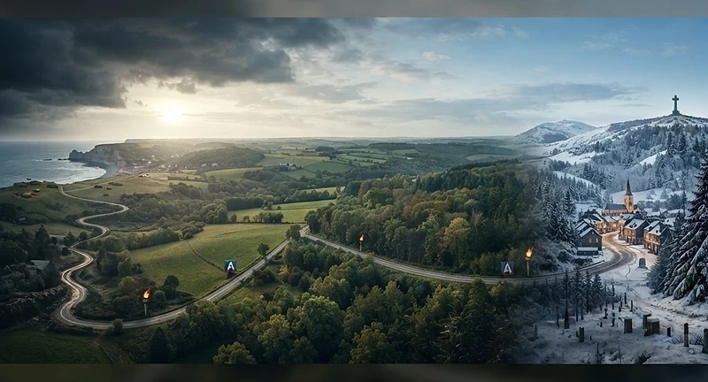
Following the Third Army from Normandy to Bastogne
This guide invites you to traverse the historic Liberty Road, the 1,147-kilometre route marking the United States Third Army’s path from the Normandy beaches to the liberation of Bastogne. Unlike typical military histories that focus solely on strategy, this book treats the route as a living landscape, blending precise historical analysis of the 1944 campaign with a practical walking guide for the modern heritage tourist. You will explore the story of General George S. Patton’s forces, from the hedgerows of Normandy to the brutal winter of the Ardennes, all while discovering the kilometre-marker bornes that still guide the way today. Each chapter details the events on the ground, what to see at specific sites, and how to navigate the route, whether you are walking in stages or tracing the history through the region’s museums and cemeteries. This is not just a book about war; it is a profound journey into the heart of memory, the reality of leadership, and the enduring human cost of conflict. Are you ready to walk the same ground that decided the fate of Western Europe?
✦Experience history firsthand by following the actual path of the Third Army from Normandy to the Ardennes.
✦Master your journey with a unique blend of deep historical analysis and practical, turn by turn travel advice.
✦Discover the living landscape of 1944 through guided tours of monuments, battle sites, and iconic markers.
If you enjoyed Patton: A Genius for War by Carlo D'Este or The Guns at Last Light by Rick Atkinson, you will love this immersive guide that combines military strategy with the reality of the physical battlefield.
Get the Book
Bought this book? Claim your free eBook
If you have already bought Patton's Road by David Oldham, tell us where to send it and we will email you the eBook version, free. You keep reading on any device.
Chapter One: How the Road Was Made There is a stone outside the town hall at Sainte-Mère-Église, and almost everyone who photographs it gets the story slightly wrong. They photograph it because it is the beginning. It stands on the square in front of the mairie, a squat pillar a little over a metre high, pink-grey, weathered, topped with a band of white stars on a blue ground. A torch rises from carved waves on its face. At its foot, a single number: zero. This is Borne 0, the first marker of the Voie de la Liberté, the Liberty Road, and the brass plate nearby will tell you it is the start of a route of 1,145 kilometres that ends at Bastogne, in Belgium, where the guns of the Battle of the Bulge fell silent in the winter of 1944. Most of that is true. The part that is not quite true is the part that makes the road interesting, and it is the reason this book exists. The road was not built by the soldiers who liberated France. It was not laid down in the summer of 1944 by the men of the United States Third Army as they fought their way east. Those men had no idea they were walking a route that would one day be marked in stone and given a name. The road was invented 15 afterwards, in peacetime, by a Frenchman who wanted the liberation remembered before the memory of it could fade. To understand the bornes, you have to understand him, and you have to understand the older road he was thinking of when he dreamed them up. His name was Guy de La Vasselais. During the war he had been a colonel, chief of the French military mission for tactical liaison attached to XX Corps of the American Third Army. He had ridden with the Americans across France. He had seen the towns come out to meet the tanks, seen the flowers thrown and the wine pressed into the hands of men who a week earlier had been strangers and were now, briefly and forever, the most welcome people in the country. He had seen, too, the cost of it, the burned villages and the white crosses going up in fields that had been pasture a month before. In June 1944, with the campaign still raging, he had already begun to think about how it should be remembered. By early 1946 the idea had taken shape. La Vasselais travelled to the United States, and on his return, in company with Gabriel Hocquard, the mayor of Metz before the war and again after it, he settled on a plan. They would mark the route the liberating armies had taken. Not with a single monument, which any town could raise and any traveller could miss, but with a chain of identical stones, one at every kilometre, running the length of the advance. A road of memory laid over the road of war. The model was already in their minds, and it came from the previous war. During the long defence of Verdun in 1916, the Patton's Road 16 single road that kept the French army supplied, the road along which men and shells and food moved up to the battle and the wounded moved back from it, had been christened the Voie sacrée, the Sacred Way. After that war it too had been marked with kilometre stones, each one carved with a soldier's helmet. La Vasselais and Hocquard had walked or driven that road. The idea of the Voie de la Liberté is, at bottom, the idea of the Voie sacrée carried forward thirty years and a few hundred kilometres west. One war's memory teaching the next how to remember itself. When you reach Verdun in this book, roughly two thirds of the way along the route, the two roads will meet, and the kinship between the helmet on the old stones and the torch on the new ones will be plain. The route they chose was the path of the Third Army. This was a deliberate choice and not the only one available, and it is worth being honest about what it means. The Liberty Road does not trace the whole liberation of France. It does not follow the British and Canadian armies who came ashore on the eastern beaches and fought their way through Caen. It does not follow the southern landings of August 1944 or the long advance up the Rhône valley. It follows one army, the army of General George S. Patton, from the Normandy coast, through the breakout in the bocage, across the great wheel east through France, into Lorraine, and finally north to the relief of Bastogne. Patton was made the honorary president of the committee that built the road. It is sometimes called, with reason, the Voie Patton. This is one Patton's Road 17 army's road, and the reader who walks it should know whose footsteps they are following and whose they are not. A national committee, the Comité National de la Voie de la Liberté, was formed in 1946 under the patronage of the President of the Republic, Vincent Auriol, along with ministers, ambassadors and Marshal Juin. The work of designing the marker itself fell to a sculptor, François Cogné. What he produced has become, in its quiet way, one of the more legible monuments in Europe, because every element of it means something. The borne is built from the bottom up as a small argument about what happened. At its base, blue waves: the Atlantic Ocean, which the Americans crossed to reach the war. Rising from the waves, a torch with a red flame, the flame of the Statue of Liberty in New York harbour, the gift France had given America sixty years before, now returning in the form of American soldiers. Around the rounded crown of the stone, forty-eight white stars on a blue band, one for each state of the United States as it was in 1944, before Alaska and Hawaii. Four red rectangles for the four sections of the route. And the letter A, for the Third Army. A reader who knew nothing else could stand before one of these stones and read the whole shape of the thing: they came across the ocean, they brought liberty, they came from a country of forty-eight states, and they were the Third Army. The original stones were cast in pink cement, stood about 1.2 metres high, and weighed some 435 kilograms each. That weight matters to the modern walker, because it is the reason most of the stones you will see in France are not the originals. A Patton's Road 18 435-kilogram block of cement standing at the edge of a fast road is a hazard, and over the decades, along the main routes, a great many of the originals were quietly replaced with lighter copies in synthetic resin, less lethal to a car that left the carriageway. The originals survive in places where the traffic never came: at Champillon in the Marne, at Frisange in Luxembourg, and along the old national road, the N4, in Belgium, climbing from the Luxembourg border at the Rosenberg all the way to Bastogne. Part of the pleasure of this road, and part of the work of this book, is learning to tell the survivors from the copies, and knowing where the real stones still stand. The road was inaugurated in stages across 1946 and 1947, and the order in which it happened is itself slightly out of joint, in the way of all real things as opposed to tidy ones. The first stone, a provisional one, went up not at the beginning of the route but in the middle, on 25 August 1946, at Saint-Symphorien-le-Château in the Eure-et-Loir, a village that happens to sit roughly halfway between Sainte-Mère-Église and Bastogne and that happened, not coincidentally, to have Guy de La Vasselais as its mayor. The terminal stone at Bastogne was laid on 5 July 1947. The famous Borne 0 at Sainte-Mère-Église, the one everyone photographs, was not inaugurated until 16 September 1947, by the American Legion. The whole route was formally opened two days later, on 18 September 1947, in the Cour des Adieux at the Palace of Fontainebleau, the courtyard where Napoleon had said goodbye to his Imperial Guard before his first exile. To help pay for it all, the French post office had issued a stamp ten days earlier, on 8 Patton's Road 19 September, designed by Charles Mazelin and engraved by Charles-Paul Dufresne: six francs of face value with a four-franc surcharge for the committee, printed in a little under two million copies and withdrawn from sale the following January. So the beginning came near the end. Borne 0 was one of the last stones placed, not the first. The road was numbered from a starting point that was christened almost last of all. And then there is the quarrel over the number itself, which I promised you at the start of this chapter and which I can now keep. When the committee designated Sainte-Mère-Église as kilometre zero, the small commune of Sainte-Marie-du-Mont, a few kilometres away on the coast, objected. Utah Beach lies within Sainte-Marie-du-Mont, and Utah Beach is where the men of the Third Army actually came ashore. How could the road to liberty begin inland, the argument ran, at a village the sea never touched, when the liberation itself had begun on the sand? Sainte-Marie-du-Mont lost the argument but refused to accept it. The commune installed its own stone, on the beach, at the edge of the dunes, and numbered it not 1 but 00. Borne double-zero. A marker that insists, politely and permanently, that the road really began here, with the boots in the water, and that the official zero a few kilometres inland is a latecomer's fiction. Both stones stand today. Borne 0 outside the mairie at Sainte-Mère-Église, garlanded every June, photographed by everyone. Borne 00 down on the beach at La Madeleine, quieter, looking out over the grey water the landing craft came in on. The book will take you to both, and I will not tell you which one is the Patton's Road 20 real beginning, because the honest answer is that they both are, and the disagreement between them is the first thing the road has to teach. One last thing before we walk. I have been writing as though the Liberty Road runs only east, and mostly it does, the long line of stones from the Cotentin to the Ardennes that this book follows. But there is a second, shorter line that most people never notice. From Sainte-Mère-Église a northern spur of fifty-nine stones, numbered 0 to 58, runs up the Cotentin peninsula towards Cherbourg, marking the drive to take the great deep-water port the Allies needed and the Germans had wrecked. It is a branch line of memory, and we will glance up it before we turn east, because the port mattered more to the campaign than the guidebooks usually allow. The numbers on the stones, then, are not as simple as the brass plates suggest. The road is called 1,145 kilometres long, and that is the figure you will see everywhere. But the final stone at Bastogne does not read 1,145. It reads 1,147, because years after the road was first laid the Belgians extended it two kilometres beyond McAuliffe Square, where the original terminal stone stood, out to the Mardasson Memorial on its hill above the town. The last borne moved, and its number grew, and the road got a little longer in memory than it had been in war. That is the road. A peacetime invention, built backwards, numbered from a disputed zero, marked by stones that are mostly no longer the stones that were first set down, commemorating one army's path through a liberation that took many. None of that Patton's Road 21 makes it less worth walking. It makes
This guide invites you to traverse the historic Liberty Road, the 1,147-kilometre route marking the United States Third Army’s path from the Normandy beaches to the liberation of Bastogne. Unlike typical military histories that focus solely on strategy, this book treats the route as a living landsca
Who wrote Patton's Road?
Patton's Road was written by David Oldham.
What genre is Patton's Road?
Patton's Road is categorized as History, Biography, Travel.
Where can I buy Patton's Road?
Patton's Road is available for purchase on Other, Amazon.
How many pages is Patton's Road?
Patton's Road has 155 pages.
When was Patton's Road published?
Patton's Road was published on October 8, 2026 by D&H Publishing International Ltd.
Can I read a sample of Patton's Road?
Yes, you can read a free sample of Patton's Road on AuthorCentral. An excerpt is available on the book page.